Williamson County TN Flood Zones Guide

Flood Zones in Williamson County TN: What Buyers Need To Know
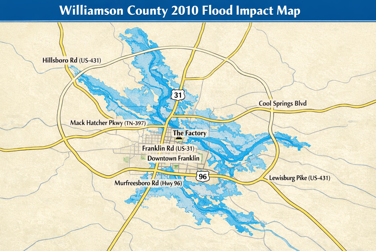
Williamson County’s landscape is shaped by winding creeks, natural drainage basins, and the Harpeth River, which means flood zones are an important part of due diligence when buying a home. Whether you’re purchasing in Franklin, Brentwood, Nolensville, Thompson’s Station, or rural Williamson County, understanding FEMA flood zone codes can help you protect your investment, manage insurance needs, and avoid costly surprises down the road.
This guide explains what each flood zone means, how floodplain regulations affect property use and value, and the key steps every buyer should take before making an offer.
Understanding FEMA Flood Zones in Williamson County
All flood zone designations used in Williamson County come from FEMA’s Flood Insurance Rate Maps (FIRMs). These maps categorize properties based on their statistical likelihood of flooding.
Here are the zones you will encounter and what they mean for buyers.
Zone X (Non-Special Flood Hazard Area)
Risk level
Low to moderate risk. These areas have a minimal chance of flooding, statistically less than a 0.2 percent annual chance.
Insurance requirement
Flood insurance is optional but often recommended because approximately 20 percent of flood claims come from properties outside high-risk floodplains.
Impact on property
• Typically the easiest zone for financing
• No elevation certificate required
• Lower insurance premiums if a buyer chooses optional coverage
• Often preferred by buyers concerned about resale value
Zone AE (High-Risk Flood Zone)
Risk level
High risk. These areas have a 1 percent annual chance of flooding (also known as the 100-year floodplain).
Insurance requirement
Mandatory for homes with federally backed mortgages.
Impact on property
• Elevation certificate required for accurate insurance rating
• Higher insurance premiums compared to Zone X
• Renovations, additions, and rebuilds must comply with county floodplain development regulations
• Some properties require flood vents, raised equipment, or engineered foundations
Zone A (High-Risk, No Base Flood Elevation Determined)
Risk level
High risk, but without specific elevation or depth data.
Insurance requirement
Mandatory with federally backed loans.
Impact on property
• Insurance companies may price policies conservatively because there is no Base Flood Elevation (BFE)
• Surveyors often must determine elevation data before issuing competitive insurance quotes
• Buyers may encounter limitations on additions or new construction permits
Zone AO or AH (Flood Depth Zones)
Risk level
Moderate to high risk in areas where shallow flooding (usually 1–3 feet) may occur.
Insurance requirement
Mandatory for financed properties.
Impact on property
• Homes often require elevated lowest-floor levels
• Insurance quotes depend on flood depth and building elevation
• Drainage improvements or retrofits may be needed
Zone VE (Coastal High Hazard Area)
Not applicable to Williamson County
Because this zone applies to coastal storm surge areas, you will not see VE designations in middle Tennessee.
How Flood Zones Impact Property Use And Building Regulations
Floodplain regulations in Williamson County and its cities exist to protect life, property, and downstream drainage systems. These regulations may influence what a buyer can or cannot do with a property.
Renovations And Additions
If a property is in an AE or A zone, any substantial improvement (typically defined as work exceeding 50 percent of the structure’s market value) must comply with floodplain construction standards. This may include:
• Raising the lowest floor above the Base Flood Elevation
• Installing flood-resistant materials
• Anchoring utilities and equipment
• Adding engineered flood vents
New Construction
New builds within identified floodplains must be elevated to or above FEMA BFE standards and may require:
• Site grading plans
• Flood studies
• No-rise certifications for areas near floodways
• Specific engineered foundation designs
These requirements can increase construction costs and should be evaluated early in your planning process.
The Floodway
Floodways are the highest-risk parts of the floodplain and have strict development rules. In most cases:
• No building is allowed unless a licensed engineer certifies that the project causes zero rise in floodwater levels
• Many parcels in the floodway are permanently undevelopable
If a seller claims a lot is “buildable,” always verify floodway status before purchasing.
What Buyers Should Consider Before Purchasing A Property In A Flood Zone
Flood risk impacts more than just insurance pricing. It affects long-term resale value, maintenance, and the true cost of ownership.
Here is what smart buyers evaluate before making an offer.
1. Flood Insurance Premium Estimates
Before you finalize a purchase in AE, A, or AH zones, request:
• A preliminary quote from an insurance broker
• The current owner’s insurance declarations page, if available
• An elevation certificate for rating accuracy
Insurance premiums can vary dramatically depending on elevation, foundation type, and local drainage conditions.
2. Past Flooding And Drainage History
A property does not need to be in a mapped flood zone to flood. Ask the seller or listing agent about:
• Previous water intrusion
• Drainage issues in the yard
• Sump pump or French drain history
• Nearby creeks or drainage basins that overflow during storms
Many buyers also walk the lot after heavy rain when possible.
3. Future Local Development
New construction upstream can alter drainage patterns. Williamson County regularly updates flood maps as developments grow, so a Zone X property today could be remapped in the future.
4. Required Disclosures
In Tennessee, sellers must disclose known drainage problems and prior flood damage. Even with disclosures, buyers should always conduct their own due diligence, including reviewing FEMA maps and county GIS layers.
5. Cost Of Future Improvements
If you plan to renovate or add square footage, ask:
• Will floodplain rules add engineering or elevation costs?
• Are utilities currently below Base Flood Elevation?
• Will new mechanical equipment need elevation platforms?
A strategic review early in the process prevents budget surprises later.
How Flood Zones Affect Resale Value
Homes in Zone X generally enjoy the broadest buyer pool. Properties in AE or A can still sell well, especially if they are elevated above BFE or have historical flood resilience, but the following should be considered:
• Buyers may factor insurance cost into their offer
• Some loan types require additional documentation
• Properties that have flooded before may face limited demand
A flood-savvy pricing and marketing strategy can offset these challenges.
Where To View Flood Maps For Williamson County TN
These resources help buyers confirm the flood zone of any property:
• FEMA Flood Map Service Center
• Williamson County GIS Mapping
• City of Franklin Floodplain Administrator resources
• Nolensville, Brentwood, and Thompson’s Station planning departments
I can also provide parcel-specific flood overlays and walk you through map interpretation if needed.
Next Steps For Buyers Planning A Move In Or Near A Flood Zone
Flood zones can be navigated successfully when you know what to look for. With the right preparation, many buyers confidently purchase homes close to water while protecting both their lifestyle and long-term investment.
If you’re relocating to Franklin, I can help you connect with verified local movers, secure temporary storage, and even schedule utility setups—all as part of my relocation concierge service.
Ready to make your move simple? Reach out to Brandy Lee with BMovingForward for trusted local referrals and relocation support.